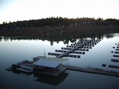
View of Heron Lake Marina from unloading area showing pavillion, dockhouse, A dock, and A-B connecting walkway. Note cross-brace truss resting on connecting walkway. Photograph was taken Sunday afternoon, December 3, 2006. Lake level was 7,144.33 feet, with 196,694 acre feet, or about 48% of capacity. The highest level in 2006 was in September when the lake had 211,000 acre feet, or 53% of its 401,000 a.f. capacity. The lake usually reaches its annual minumum in April, shortly before the arrival of significant spring runoff from the Azotea Tunnel and San Juan-Chama project. Slightly beyond the left side of the picture is the location of the Willow Creek boat ramp and mast-up storage lot.

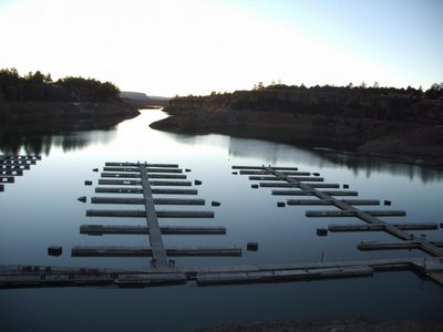
View of B and C docks showing 30" x 60" x 20" floats that are being used to support the long trusses. The long trusses are partially unbolted so that they could swing out and up and not be trapped under the piers during next spring's low-water period. Beyond the marina is the "Narrows" and the main body of Heron Lake. To the right is the outlet of Willow Creek Cove.

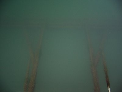
Trusses have been swung up and now are floating only about a foot below the surface. A long truss is faintly visible near top of photograph.
 View of Heron Lake Marina from unloading area showing pavillion, dockhouse, A dock, and A-B connecting walkway. Note cross-brace truss resting on connecting walkway. Photograph was taken Sunday afternoon, December 3, 2006. Lake level was 7,144.33 feet, with 196,694 acre feet, or about 48% of capacity. The highest level in 2006 was in September when the lake had 211,000 acre feet, or 53% of its 401,000 a.f. capacity. The lake usually reaches its annual minumum in April, shortly before the arrival of significant spring runoff from the Azotea Tunnel and San Juan-Chama project. Slightly beyond the left side of the picture is the location of the Willow Creek boat ramp and mast-up storage lot.
 View of B and C docks showing 30" x 60" x 20" floats that are being used to support the long trusses. The long trusses are partially unbolted so that they could swing out and up and not be trapped under the piers during next spring's low-water period. Beyond the marina is the "Narrows" and the main body of Heron Lake. To the right is the outlet of Willow Creek Cove.
 Trusses have been swung up and now are floating only about a foot below the surface. A long truss is faintly visible near top of photograph.


2 Comments:
looks peaceful, but that channel looks like a bear to navigate in a sailboat... especially under sail.
Some folks don't try to sail the Narrows and would rather motor. But, for real fun, try racing another boat up or down the winding passage while the wind is switching and coming and going! The good news is that the channel is normally quite deep, and sailboats can carry on close to the walls, so long as someone doesn't get too close to an occasional sharp rock near the walls.
Post a Comment
<< Home